0 1 5 3 0 5 1 8 5 1 8
You are currently on our UK site
Search postcode, location or OS reference:


Instant access, to up-to-date, highly accurate geographic data on the Bluesky Mapshop
MetroVista™
LIDAR, oblique & vertical imagery in one
Cities are evolving…and Bluesky is mapping their future.
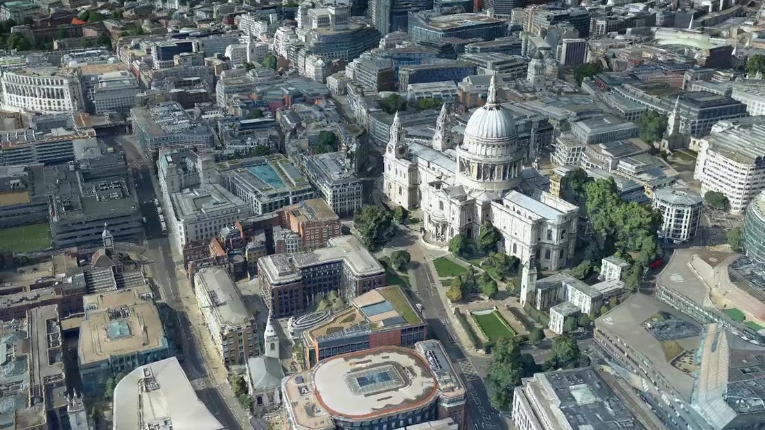
The CityMapper from Leica has enabled Bluesky to capture several UK cities in a way that has never been achieved before. The Leica CityMapper is the world’s first hybrid airborne sensor combining oblique and nadir imaging as well as a LiDAR system into one sensor. Bringing together the best of both worlds, the CityMapper is specifically designed for urban mapping. Combined with the high-performance post-processing workflow, it offers a complete 3D urban mapping solution.
We live in a 3D world, so why do we still use 2D maps?
Once again Bluesky offers the foundation to make smart decisions in rapidly changing urban environments. 3D models are no longer just nice to have pretty pictures, they are the key to unlocking the value in the smart city revolution and have at last become a viable replacement for traditional 2D GIS solutions. The CityMapper’s simultaneous data gathering capabilities provide all the necessary outputs to deliver traditional 2D aerial ortho products or highly detailed static obliques, dense LiDAR point clouds or grids, and once combined, 3D city visualisations that are both aesthetically stunning and technically accurate.
The future of aerial survey is here… Mapping has evolved.
MetroVista™ cities captured include:
-
Birmingham
-
Bournemouth
-
Brighton
-
Bristol
-
Cambridge
-
Cardiff
-
Derby
-
Doncaster
-
Eastbourne
-
Edinburgh
-
Glasgow
-
Leicester
-
London
-
Manchester
-
Newcastle
-
Norwich
-
Nottingham
-
Oxford
-
Southend
LATEST METROVISTA NEWS
VIEW CITYMAPPER IN THE SKYLINE 3D VIEWER
Bluesky is able to bring CityMapper data to life and make it easy to share with Skyline online 3D viewer which is one of the most powerful geospatially enabled virtual worlds available. It enables organisations to view and query all of their GIS and other geospatial data over real terrain and in a fully interactive 3D environment, then serve this up over the internet to the users within the organisation or even the wider pubic, through an easy-to-use and familiar web browser interface.


