top of page
0 1 5 3 0 5 1 8 5 1 8
You are currently on our UK site
Search postcode, location or OS reference:


Instant access, to up-to-date, highly accurate geographic data on the Bluesky Mapshop
Search


Bluesky Partners FATMAP to Create Interactive 3D Ski (M)apps
Aerial mapping company Bluesky is working with FATMAP to create ultra- high resolution 3D mobile maps of the world’s major ski resorts...
Dec 17, 20152 min read


Bluesky’s 3D Aerial Maps Inform Flood Risk Assessments for Planning Applications
Aerial photography and detailed 3D height models are being used to assess the risk of flooding, and help development projects progress...
Dec 9, 20152 min read


Bluesky Achieves Irish Aerial Survey Milestone
Aerial mapping company Bluesky is celebrating a successful 2015 flying season in Ireland. Having captured nearly 10,000 square kilometres...
Dec 3, 20152 min read


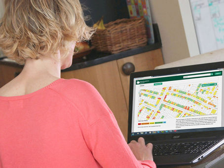
Bluesky Aerial Thermal Map Helps Keep Herefordshire Residents Warm
An aerial thermal survey to assess heat loss from homes is being used by Herefordshire Council to raise awareness of poor home energy...
Nov 19, 20152 min read


Bluesky Aerial Laser Survey set to Reveal Hidden Iron-Age Archaeology
High tech aerial laser surveying technology is being employed to reveal the hidden archaeology of an Iron-Age hill settlement in...
Nov 12, 20152 min read


Aerial Mapping Pioneer Bluesky Supports Clean Energy Campaign
Aerial mapping company Bluesky is backing a charity’s campaign to protect the subsidies for clean energy projects. Under recent...
Oct 23, 20152 min read


Bluesky Completes Project to Laser Map East Anglia and the South East
Bluesky has completed a multi-million pound aerial mapping project to assess the impact of vegetation on the electricity network of East...
Oct 7, 20152 min read


Bluesky Helps Scientists Understand Impact of Urban Trees on Air Quality
Aerial mapping company Bluesky has supported a major research project by scientists from the University of Leicester into the role of...
Sep 3, 20152 min read


Bluesky Maps Solar Potential of 100,000 Properties
Working with resource efficiency company Sustain, Bluesky has mapped around 100,000 Housing Association properties across the UK,...
Aug 26, 20152 min read


View the History of Britain from the Air as Bluesky Brings Old Aerial Photos Online
Thousands of aerial photographs, dating back more than seventy years, are now available online. Visitors to www.blueskymapshop.com can...
Aug 6, 20152 min read


Bluesky Announces Prototype UAV Flight Restriction Map
Aerial mapping company Bluesky has produced a prototype map showing where it may be unsafe or even illegal to fly Unmanned Aerial...
Jul 28, 20152 min read


UK Flood Map New for Bluesky Mapshop
Following an agreement between aerial mapping company Bluesky and hazard mapping specialists JBA Risk Management, visitors to...
Jul 14, 20152 min read


Aerial Mapping Company Bluesky Expands
Aerial mapping specialist Bluesky has completed a significant recruitment programme, expanding its Leicestershire based workforce by more...
Jul 7, 20152 min read


Bluesky Mapshop Now Serving British Geological Survey Data
An agreement between the British Geological Survey (BGS) and aerial mapping company Bluesky is allowing for a range of geological and...
Jun 30, 20152 min read


Bluesky Data Used to Model Major Infrastructure Projects
Aerial photography and computer generated models of buildings and trees from Bluesky are helping specialist graphics company 3D Web...
Jun 23, 20152 min read
bottom of page
