top of page
0 1 5 3 0 5 1 8 5 1 8
You are currently on our UK site
Search postcode, location or OS reference:


Instant access, to up-to-date, highly accurate geographic data on the Bluesky Mapshop
Search


Bluesky’s National Tree Map Helps Council Map Trees
A detailed digital map of tree canopy cover is helping Central Bedfordshire Council gain an understanding of how many trees are on land...
Apr 15, 20142 min read


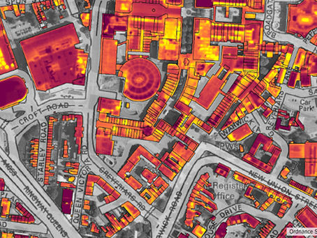
Bluesky Heat Loss Map Helps Keep Coventry Residents Keep Warm
Coventry City Council is helping residents stay warm this winter with targeted advice and support for those with poor insulation or at...
Apr 10, 20142 min read


Bluesky Aerial Survey Data Helps Harrow Council Tackle Growing Beds in Sheds Problem
Thermal imaging and laser scan data collected by aircraft is helping Harrow Council tackle the growing problem of unscrupulous landlords...
Mar 21, 20142 min read


Bluesky Announces Commercial Trials of Airborne Air Quality Mapper
Aerial mapping company Bluesky is launching a service to map air quality across towns and cities. Having successfully completed a project...
Feb 13, 20142 min read


Aerial night maps of Leicester to look at energy usage
A Leicestershire firm has taken these aerial photographs of Leicester during the day and then at night to see how much light is being...
Feb 6, 20141 min read


Bluesky Soars with Eagle Aerial Mapping Camera
Aerial mapping company Bluesky is taking to the skies with a new large format digital aerial photogrammetric camera. Purchased from...
Jan 23, 20142 min read


Bluesky to map energy wastage from homes across Britain’s cities
Aerial mapping company Bluesky has been awarded contracts to map heat loss across towns and cities covering around 10 per cent of the...
Jan 14, 20142 min read


Bluesky and a host of other UK companies have been propelled by multi-million pound funding courtesy
The Government's Regional Growth Fund, available to RBS, NatWest and Lombard’s small and mid tier commercial customers, lent £70m in the...
Dec 13, 20132 min read


Bluesky Celebrates Milestone Birthday
Aerial mapping company Bluesky is celebrating its tenth anniversary. Since its inception in 2003 Bluesky has evolved into a leading...
Dec 12, 20132 min read


Bluesky Appoints Robert Loughran as International Sales Manager
Aerial mapping company Bluesky has appointed Robert Loughran, an experienced geospatial business development executive, to the position...
Dec 9, 20132 min read


Bluesky Helps UK Government Research into Viability of Solar Energy to UK PLc
Aerial mapping company Bluesky is supporting a million pound research project into the potential costs and benefits of solar energy in...
Dec 5, 20132 min read


Bluesky Aerial PhotoMap Stars alongside Alan Partridge
A large aerial photomap from Bluesky is making a cameo appearance in Alan Partridge’s big screen debut Alpha Papa. Forming a backdrop for...
Nov 5, 20132 min read


Bluesky Completes National Tree Map™
Aerial mapping company Bluesky has completed the first ever detailed digital map of tree canopy cover. The National Tree Map™ (NTM™ has...
Oct 21, 20132 min read


Bluesky Helps Peak District National Park
High resolution aerial photomaps and laser surveyed 3D terrain maps from Bluesky are being used to plan and implement vital moorland...
Oct 7, 20132 min read


James Eddy receives honorary title from University of Leicester
James Eddy, Technical Director of aerial survey specialist Bluesky, has been conferred the honorary title and status of Industrial...
Sep 16, 20132 min read
bottom of page
